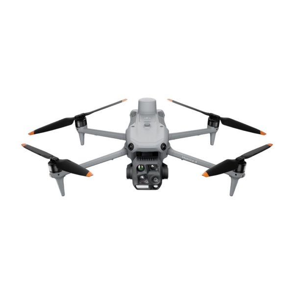
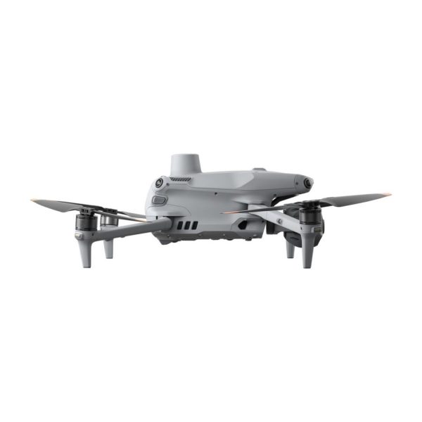
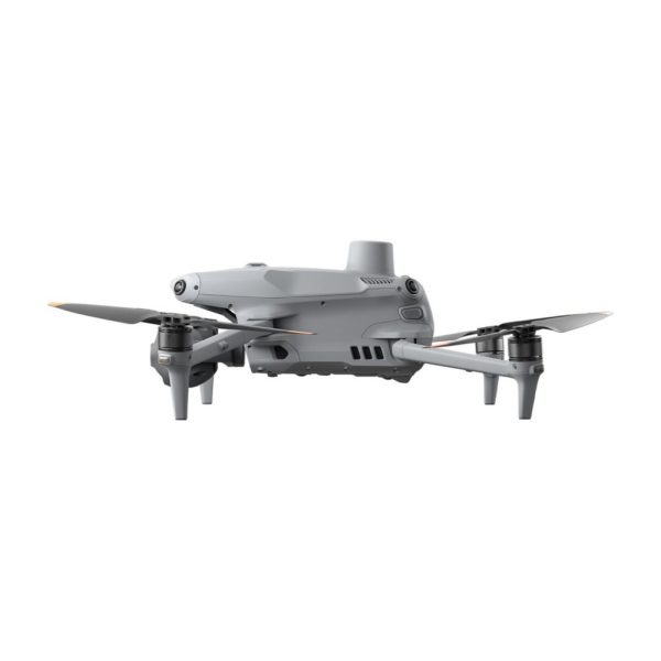
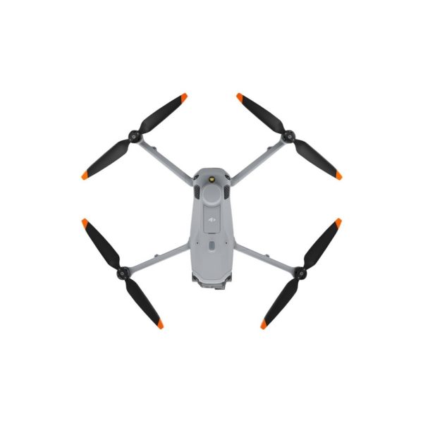
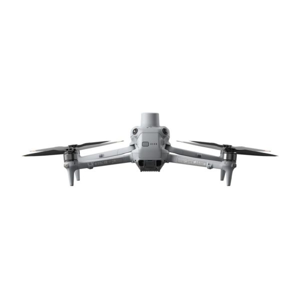
DJI Matrice 4T

on order
SKU: DJI M4T
6730,73inc. VAT
5608,94ext. VAT

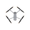
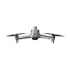
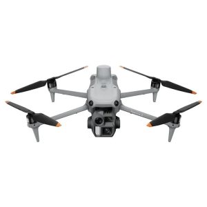
The new compact and intelligent multi-sensor flagship drone Matrice 4T – suitable for a wide range of industries, including electricity, emergency response, public safety, and forestry conservation.

Frequently bought together

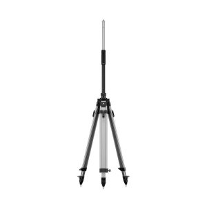
D-RTK 3 Survey Pole and Tripod Kit

395,12inc. VAT
329,27ext. VAT

The new D-RTK 3 Survey Pole and Tripod Kit features a self-locking survey pole with easy height adjustment and a dual-lock tripod for easy leveling.The survey pole and tripod are designed to work together seamlessly with the D-RTK 3 Multifunctional Station, allowing flexible configuration based on different scenarios.In base station mode, it provides stable setup for high-precision drone missions. In rover station mode, the survey pole can be used independently for control point and check point data collection.

View more

D-RTK 3 Multifunctional Station

1560,97inc. VAT
1300,81ext. VAT

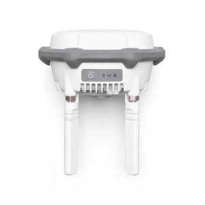
The new D-RTK 3 Multifunctional Station integrates high-performance antennas and receiver modules, capable of tracking and resolving data from major global satellite navigation systems. It supports multiple data transmission links and can analyze device position and orientation through its built-in high-performance inertial measurement unit. With these outstanding features, it can serve as a base station to provide centimeter-level positioning for multiple drones simultaneously, or extend the operational range of drones in relay station mode. Additionally, the new rover station mode, combined with the DJI ENTERPRISE app and DJI Terra, offers a one-stop solution for high-precision aerial surveying applications.

View more

DJI AS1 Speaker

223,42inc. VAT
186,18ext. VAT

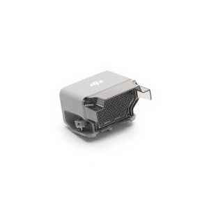
Louder volume, further reach. The DJI AS1 Speaker can reach 114 decibels at 1 meter, with a broadcast range of up to 300 meters. It supports recorded messages, media imports, and text-to-speech conversion. Additionally, it features real-time broadcasting and echo suppression. The spotlight and speaker can be used independently or in combination, meeting the needs of more operational scenarios.

View more

Description

DJI Matrice 4T

The Age of Intelligent Flight
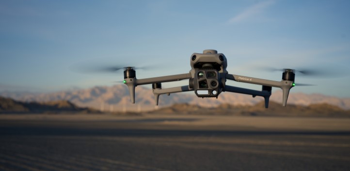
Introducing the DJI Matrice 4 Series, a new compact and intelligent multi-sensor flagship drone series for enterprise industries. Flight operations are now safer, more reliable, and powered by AI, with significantly enhanced sensing capabilities. The accessories for the Matrice 4 series have also been significantly upgraded. The Matrice 4T is suitable for a wide range of industries, including electricity, emergency response, public safety, and forestry conservation.
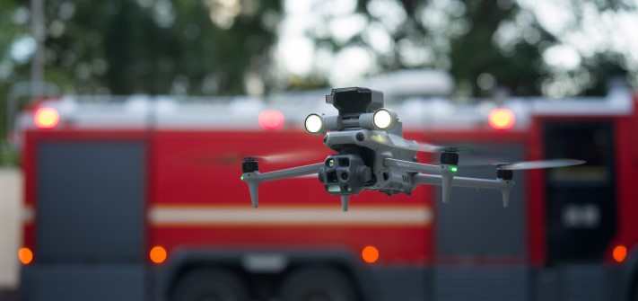
Wide-Angle Camera

1/1.3″ CMOS, 48MP Effective Pixels, f/1.7, Format Equivalent: 24 mm

Medium Tele Camera

1/1.3″ CMOS, 48MP Effective Pixels, f/2.8, Format Equivalent: 70 mm

Tele Camera

1/1.5″ CMOS, 48MP Effective Pixels, f/2.8, Format Equivalent: 168 mm

Laser Range Finder

Measurement Range: 1800 m (1 Hz); Oblique Incidence Range (1:5 Oblique Distance): 600 m (1 Hz) Blind Zone: 1 m; Range Accuracy (m): ± (0.2 + 0.0015 × D)

Infrared Thermal Camera

Resolution 640 × 512, f/1.0, Equivalent Focal Length: 53 mm, Uncooled VOx Microbolometer, Supports High-Res Mode

NIR Auxiliary Light

FOV: 6°, Illumination Distance: 100 m

AI Power for Smarter Operations

The built-in AI model can detect vehicles, vessels, and subjects during search and rescue operations or routine flights. It also supports switching to other models, enabling the expansion of AI application scenarios. Additionally, it supports high-res grid photos and features powerful tracking capabilities.

Laser Range Finder, Precise Measurement

The laser range finder enables real-time precise measurement. Through simple operations such as pin point, line drawing, and area calculation, it can complete tasks like marking target locations for inspection purposes or calculating the area of a wildfire. Additionally, users can share info via the DJI Pilot QR code or FlightHub 2 with relevant personnel to enhance collaboration and workflow efficiency.

Observation Range Recording

DJI Pilot 2 can highlight the center position of the camera frame and ground area observed. It can display the surveyed area on the map, making it especially useful for patrols, and rescue operations in mountainous terrain without clear landmarks.

Efficient Flight, Intelligent Operations

Cruise

Activate cruise control mode to pilot the drone in a specific direction without constantly pressing the control sticks, making long-distance flights easier.

FlyTo

In emergencies or disasters, the drone can automatically adjust its flight path and speed based on the surrounding environment, allowing it to reach a designated location without manual adjustments.

Smart Track

Smart Track allows for precise subject positioning and automatic zoom adjustments, allowing you to switch between subjects easily. It can automatically reacquire a subject even if obscured briefly.

POI

POI enables continuous observation and 3D modeling of buildings while flying around a designated area, greatly enhancing the efficiency of fixed-point observation and modeling tasks.

Excel In Low-Light Environments

Night Scene Mode

The Matrice 4 series has received a significant night mode upgrade. Its Full-Color night vision now supports three modes and includes two levels of enhanced noise reduction. Equipped with an IR Cut Filter and NIR auxiliary light, it effortlessly overcomes the challenges of darkness, ensuring search and rescue subjects clearly visible.

Smart Low-Light Photo

The Matrice 4 series cameras feature larger apertures and intelligent low-light capabilities, significantly enhancing performance and improving operations during dusk and nighttime.

NIR Auxiliary Light

The Matrice 4T features new NIR illumination hardware, enabling lighting distances of up to 100 meters. This ensures clear visibility of objects in dark environments, making it ideal for applications like wildlife protection.

Thermal Imaging

The Matrice 4T supports infrared High-Res Mode, with image resolutions up to 1280 × 1024. It also offers Ultra-High Resolution, revealing small temperature details for various operations. Each device undergoes temperature accuracy calibration and utilizes an onboard temperature sensor to provide real-time temperature measurements.

Low-Light Fisheye Omnidirectional Sensing

The Matrice 4 series has six high-definition low-light fisheye vision sensors, significantly enhancing visual low-light positioning and obstacle avoidance capabilities. This allows for automatic obstacle avoidance, intelligent rerouting, and safe return in urban low-light environments.

Crystal Clear Vision: Unveil the Details

Enhanced Medium Telephoto

The Matrice 4 series is equipped with a medium tele camera, expanding its capabilities for medium-range inspection tasks. During power line or bridge inspections, it can detect screws and cracks from a distance of 10 meters and clearly read instrument data at substations.

Super Resolution Telephoto

The tele camera of the Matrice 4 series has significantly improved clarity, featuring 48 MP resolution, capable of capturing incredibly details from signs up to 250 meters away. Additionally, the Matrice 4T is equipped with an IR-Cut Filter, ensuring 24/7 operations.

Foreground Stabilization for Telephoto Imagery

The upgraded telephoto stabilization makes foreground subjects stable and clear during telephoto shooting at 10x zoom or higher. In scenarios such as public safety and inspections, subject details are clearly visible.

Electronic Dehazing, Clear as Ever

In conditions such as smog or atmospheric humidity, Electronic Dehazing supports three modes (Low, Medium, High) to improve the imaging clarity of the Matrice 4 series to match different operational environments and requirements.

Safe Flight, Worry-Free Operation

Fusion Positioning, Safe Return-to-Home

The Matrice 4 series comes with an integrated DJI RTK module which supports the extended L5 frequency band and features GNSS+Vision Fusion Positioning and Navigation System. It allows for the return-to-home point to be updated through visual positioning, allowing for rapid takeoff within 15 seconds. Even without GNSS signals, it can complete the return-to-home process, effectively overcoming signal obstructions and interference commonly found in urban environments.

Intelligent Guidance, Unobstructed Flight

When the DJI RC Plus 2 Enterprise remote controller is connected to the internet, it can load terrain elevation maps and preload detailed maps. This enables automatic path planning for obstacle avoidance, effectively managing scenarios such as flying at night or through mountainous areas, ensuring the safety of flight operations. The drone has a 5-directional vision assist view system along with downward vision, which aids in providing comprehensive visibility for enhanced protection.

Achieve New Heights in Video Transmission

The O4 Enterprise video transmission system sets a new industry standard for challenging environments. Thanks to the 8-antenna system in the Matrice 4 Series and the high-gain antenna in the remote controller, you can achieve up to 25 kilometers in transmission range. Furthermore, the system improves image transmission with a download bandwidth of 20MB/s, more than double the bitrate of the Mavic 3 Enterprise Series, ensuring more precise and stable images of route uploads and material downloads.

The Matrice 4 series supports an optional DJI Cellular Dongle 2. By utilizing 4G image transmission in conjunction with the aircraft’s antennas, signal stability is further enhanced.

Aircraft

Takeoff Weight (with propellers)
1219 g
Takeoff Weight (with Low-Noise propellers)
1229 g
Max Takeoff Weight
Standard Propellers: 1420 g Low-Noise Propellers: 1430 g
Dimensions
Folded: 260.6×113.7×138.4 mm (L×W×H) Unfolded: 307.0×387.5×149.5 mm (L×W×H)
Max Payload
200 g
Propeller Size
10.8 in
Diagonal Wheelbase
438.8 mm
Max Ascent Speed
10 m/s
Maximum Ascent Speed With Accessories
6 m/s
Max Descent Speed
8 m/s
Max Descent Speed With Accessories
6 m/s
Max Horizontal Speed (at sea level, no wind)
21 m/s
Max Altitude
6000 m
Max Operating Altitude with Payload
4000 m
Max Flight Time (without wind)
49 min (standard propellers) 46 min (low-noise propellers)
Max Hover Time (without wind)
42 min (standard propellers) 39 min (low-noise propellers)
Max Flight Distance (no wind)
35 km (standard propellers) 32 km (low-noise propellers)
Max Wind Speed Resistance
12 m/s*
Max Pitch Angle
35°
Operating Temperature
-10℃ to 40℃ (14°F to 104°F)
GNSS
GPS + Galileo + BeiDou + GLONASS
Hovering Accuracy Range (windless or breezy)
±0.1 m (with Vision System); ±0.5 m (with GNSS); ±0.1 m (with RTK)
RTK GNSS Accuracy
1 cm + 1 ppm (horizontal), 1.5 cm + 1 ppm (vertical)
Internal Storage
N/A
Ports
E-Port interface × 1: Supports official accessories and third-party PSDK devices (hot-swapping is not supported) E-Port Lite interface × 1: supports USB connection to DJI tuning software and some third-party PSDK devices.
Propeller Model
1157F (standard propellers) 1154F (low noise propeller)
Beacon
Built into the aircraft

Camera

Image Sensor
Wide: 1/1.3-inch CMOS, Effective Pixels: 48 MP Medium Tele Camera: 1/1.3-inch CMOS, Effective Pixels: 48 MP Telephoto: 1/1.5-inch CMOS, Effective Pixels: 48 MP
Lens
FOV: 82° Equivalent Focal Length: 24 mm Aperture: f/1.7 Focus: 1 m to ∞
Lens
Medium Tele Camera FOV: 35° Equivalent Focal Length: 70 mm Aperture: f/2.8 Focus: 3 m to ∞
Lens
Tele camera FOV: 15° Equivalent Focal Length: 168 mm Aperture: f/2.8 Focus: 3 m to ∞
ISO Range
Normal Mode: ISO 100 to ISO 25600
ISO Range
Night Scene Mode: Matrice 4T: Wide Camera: ISO 100 to ISO 409600 Midum Tele Camera: ISO 100 to ISO 409600 Tele Camera: ISO 100 to ISO 819200
Shutter Speed
2-1/8000 s
Max Photo Size
Wide: 8064 × 6048 Medium Telephoto: 8064 × 6048 Telephoto: 8192 × 6144
Minimum Photo Interval
0.7 s
Video Codec
Video Coding Format: H.264/H.265 Coding Strategy: CBR, VBR
Resolution
4K: 3840 × 2160@30fps FHD: 1920 × 1080@30fps
Max Video Bitrate
H.264: 60Mbps H.265: 40Mbps
Supported File System
exFAT
Photo Format
JPEG
Video Format
MP4 (MPEG-4 AVC/H.264)
Digital Zoom
Telephoto: 16x (112x hybrid zoom)

NIR Auxiliary Light

Infrared Illumination
FOV: 5.7°±0.3°

Laser Module

Measurement Range
1800 m (1 Hz) @20% reflectivity target
Oblique Incidence Range
600 m (1 Hz) Blind Zone: 1 m
Distance Measurement Accuracy
1-3 m: System Error <0.3 m, Random Error <0.1 meters @1σ

Infrared Thermal Camera

Thermal Imager
uncooled vanadium oxide (VOx)
Resolution
640 × 512
Pixel Pitch
12 μm
Frame Rate
30 Hz
Lens - DFOV
45°±0.3°
Lens - equivalent focal length:
53 mm
Lens - Aperture:
f/1.0
Lens - Focus:
5 m to ∞
Sensitivity
Temperature Measurement Method
Spot Meter, Area Measurement
Temperature Measurement Range
High Gain Mode: -20℃ to 150℃ (-4°F to 302°F) () Low Gain Mode: 0℃ to 550℃ (32°F to 1022°F)
Palette
White Hot/Black Hot/Tint/Iron Red/Hot Iron/Arctic/Medical/Fulgurite/Rainbow 1/Rainbow 2
Photo Format
JPEG (8bit)、 R-JPEG (16bit)
Video Resolution
1280 × 1024@30fps (Super Resolution enabled, Night Mode not activated)
Video Bitrate
6.5Mbps (H.264 640 × 512@30fps) 5Mbps (H.265 640 × 512@30fps) 12Mbps (H.264 1280 × 1024@30fps) 8Mbps (H.265 1280 × 1024@30fps)
Video Format
MP4
Photo Resolution
Infrared: 1280 × 1024 (Super Resolution on) 640 × 512 (Super Resolution off)
Digital Zoom
28x
Infrared Wavelength
8um to 14um
Infrared Temperature Measurement Accuracy
High Gain: ±2℃ or ±2%, whichever is greater Low Gain: ±5℃ or ±3%, whichever is greater

Gimbal

Stabilization System
3-axis (tilt, roll, pan)
Mechanical Range
Gimbal Mechanical Limits: Tilt: -140° to 113° Roll: -52° to 52° Pan: -65° to 65°
Controllable Rotation Range
Pan: ±-90° to 35° Pan: Not controllable
Max Control Speed (tilt)
100°/s
Angular Vibration Range
±0.007°
Yaw Axis
Manual operation is uncontrollable
Ingress Protection Rating
No Standard Protection Level
Operating Temperature
Standard: -10°C to 40°C (14°F to 104°F)

Sensing

Sensing Type
Omnidirectional binocular vision system, supplemented with a 3D infrared sensor at the bottom of the aircraft.
Operating Environment
Forward, Backward, Left, Right, and Upward: Delicate texture on the surface, adequate light.
Operating Environment
Downward: The ground has rich textures and sufficient lighting conditions

Video Transmission

Video Transmission System
O4 Enterprise
Live View Quality
Remote Controller: 1080p/30fps
Operating Frequency
2.400-2.4835 GHz 2.400-2.4835 GHz 5.725-5.850 GHz 5.150-5.250 GHz (CE)
Max Transmission Distance (unobstructed, free of interference)
25 km (FCC) 12 km (CE) 12 km (SRRC) 12 km (MIC)
Max Transmission Distance (with interference)
Strong Interference - City Centers (approx. 1.5-5 km) Medium Interference - Suburban Areas (approx. 5-15 km) Micro interference:Suburbs/Seasides (approx. 15-25 km)
Max Download Speed
20 MB/s
Latency
130 ms
Antenna
8 antennas, 2T4R
Others
Cellular Dongle Compartment

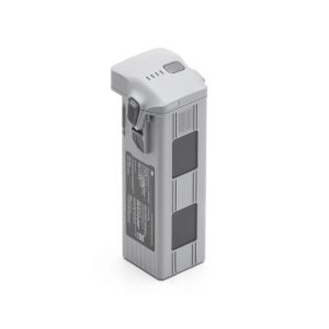
Intelligent Flight Battery

Capacity
6741 mAh
Standard Voltage
14.76 V
Max Charging Voltage
17.0 V
Cell Type
Li-ion 4S
Energy
99.5 Wh
Weight
401 g
Recharging Temperature
5°C to 40°C (41°F to 104°F)
Discharge Rate
4C
Max Charging Power
1.8C
Supports low-temperature charging
Not supported
Cycle Count
200

Power Adapter (100W)

Input
100-240 V (AC), 50-60 Hz, 2.5 A
Output
Max. 100 W (total)
Rated Power
100 W

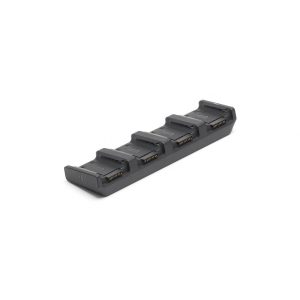
Charging Hub

Input
USB-C:5-20 V, max 5 A
Output
Battery Interface: 11.2 V to 17 V
Rated Power
100 W
Recharging Type
4 batteries charging in sequence
Compatible Battery
DJI Matrice 4E/T Series Intelligent Flight Battery
Charging Temperature
5° to 40° C (41°F to 104°F)

You may also like…

Item is out of stock, but already on the way. Please, contact us for details

6730,73

Tax included

You were not leaving your cart just like that, right?

Don't Miss Out!

Simply enter your email below to save your cart and we'll send you a reminder. It's quick, easy, and ensures you won't lose track of your selections. Happy shopping!