Save Manual Operations as automatic plots
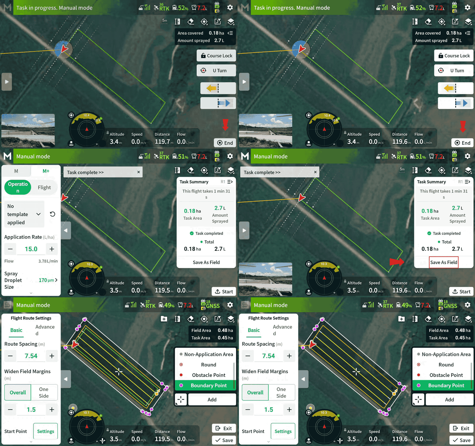
The flight path from a manual flight or a manual boundary flight can now be saved as a field with one click for automatic use later. This is helpful for small plots, where you can fly once and save it for repeated use. Pilots can save time on larger plots by manually spraying field boundaries and automatically spraying the rest of the field.
Notes:
- The green track on the outermost circle determines the coverage area of the plot. Ensure that the edges of the plot are covered by the green track to avoid omissions.
- When using this function to encircle the plot, since the edges have already been sprayed, be sure to edit and adjust the route separately (route spacing, margin, boundary spraying, etc.) to avoid overspraying or missing spots.
Add Marker Lines and Points
When planning flight routes, you can now add marker lines and points to points of interest on the map.
Application Examples:
Marker Lines: Can be used to mark the location of power lines within the plot, making it easier to track their location relative to the drone during operations.
Marker Points: Can be used to mark objects in fields, making it easier to locate and find them quickly after covering the soil.

Notes:
- Unlike field boundary points and obstacle points, marker lines and points do not affect route planning or flight operations; they are only used for position display.
- Marker lines and points cannot be saved separately. They need to be added to boundary points and saved as a plot.
Low Speed Ascend at the start point
After a refill or battery swap, when the drone returns to the start point or break point, its propeller downwash at low altitude and speed may cause some crops to lodge.
After enabling Low Speed Ascend, the drone can descend and spray from the set Low Speed Ascend height, reducing the risk of lodging.
The start-spraying height is Operation Height plus Low Speed Ascend Height
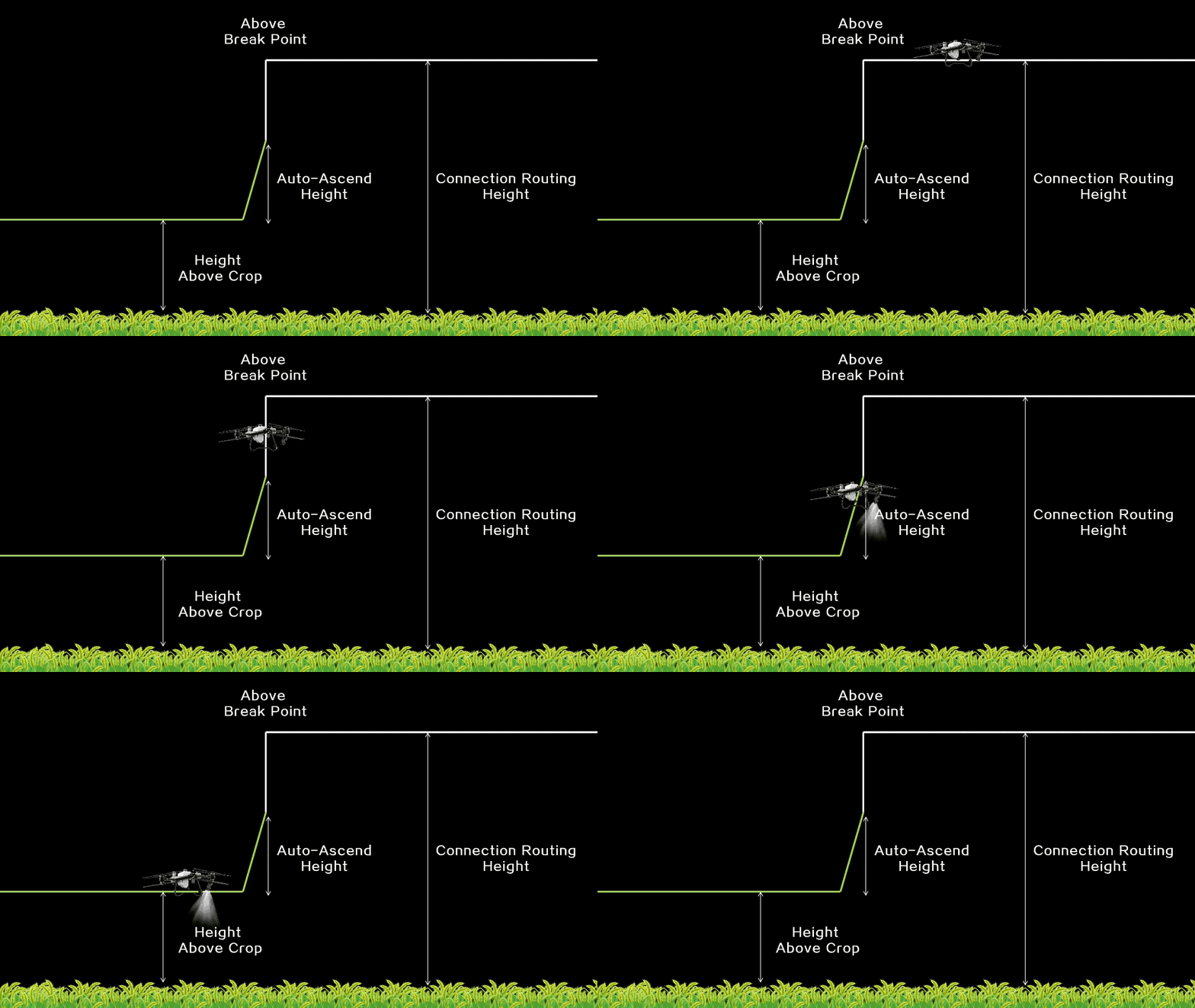
Note:
- Enabling Low Speed Ascend will apply to all turns and starting points (breakpoints). Please use it only where there are no obstacles at the field boundaries and in the field.
Added Route Visualization function in M+ mode
In M+ mode, Route Visualization helps users find the breakpoint and align the drone’s direction according to guidelines. This helps users avoid route deviation and inconsistent spacing.
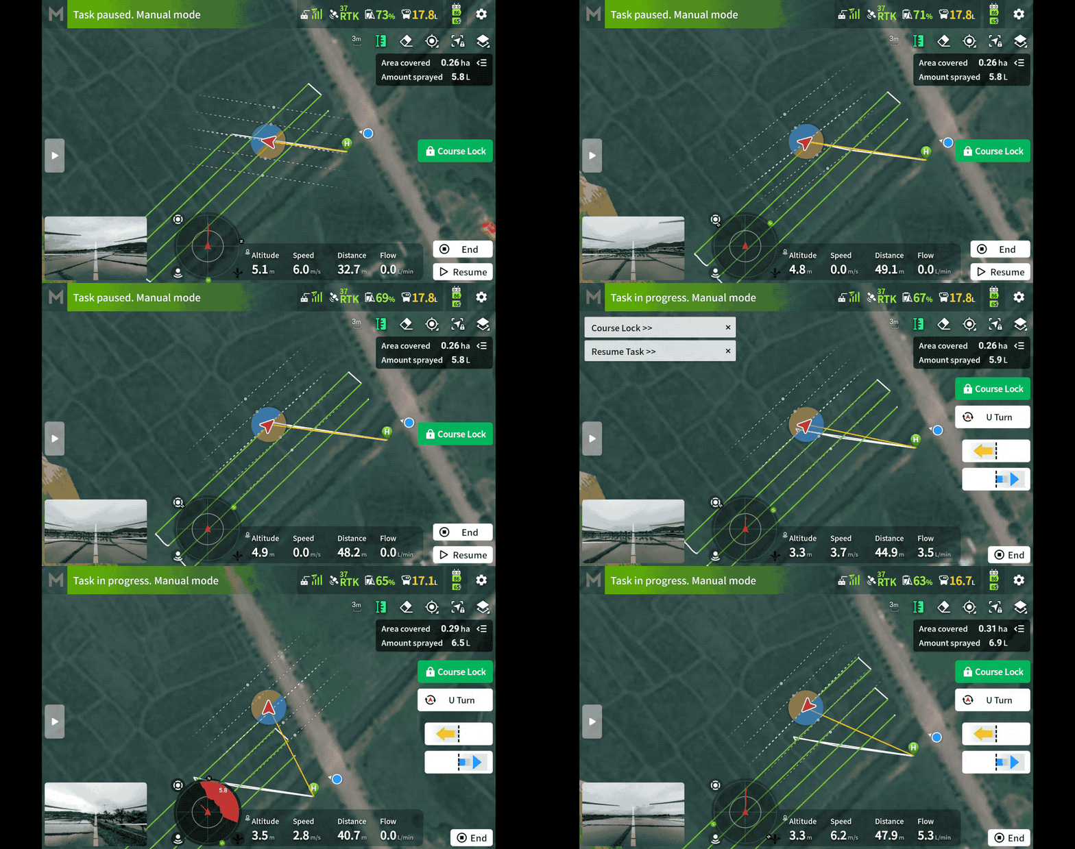
Note:
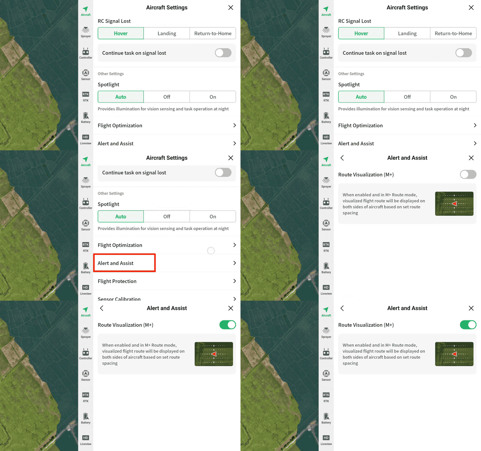
- To disable this feature, go to “Top Right Corner Settings – Aircraft Settings – Alert and Assist – Route Visualization (M+)” and choose to turn it off.
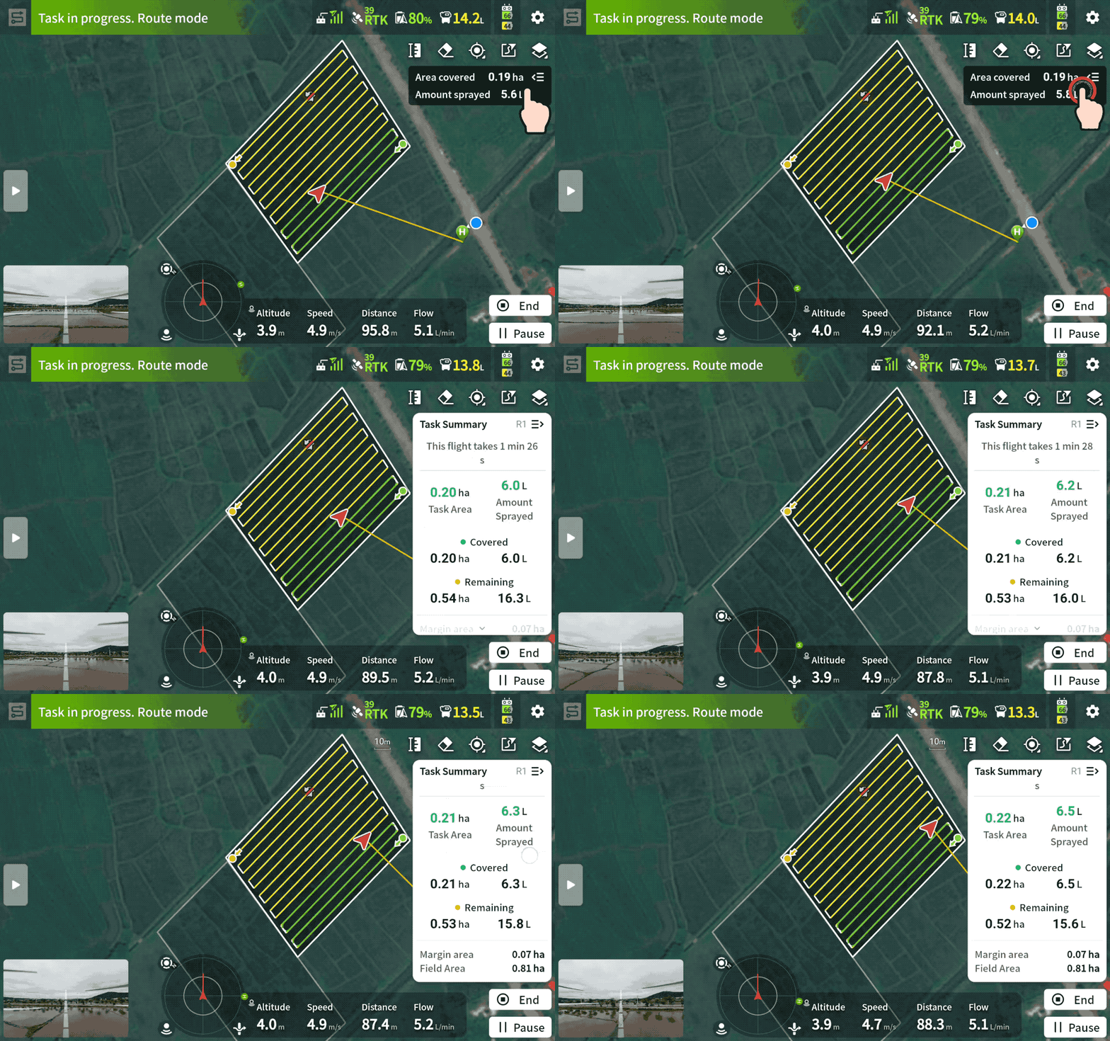
Task Summary is available in real time during operations
During operations, you can view task summaries in real-time, including completed work data, estimated chemical usage, and the remaining work to be done.
Multi Plot Operations get some optimizations
Multi Plot Operations now supports Empty Tank Point estimation and Automatic RTH.
When using Multitask, Empty Tank Point estimation can now span multiple plots, showing the estimated Empty Tank Point based on the actual volume of chemical left in the tank.
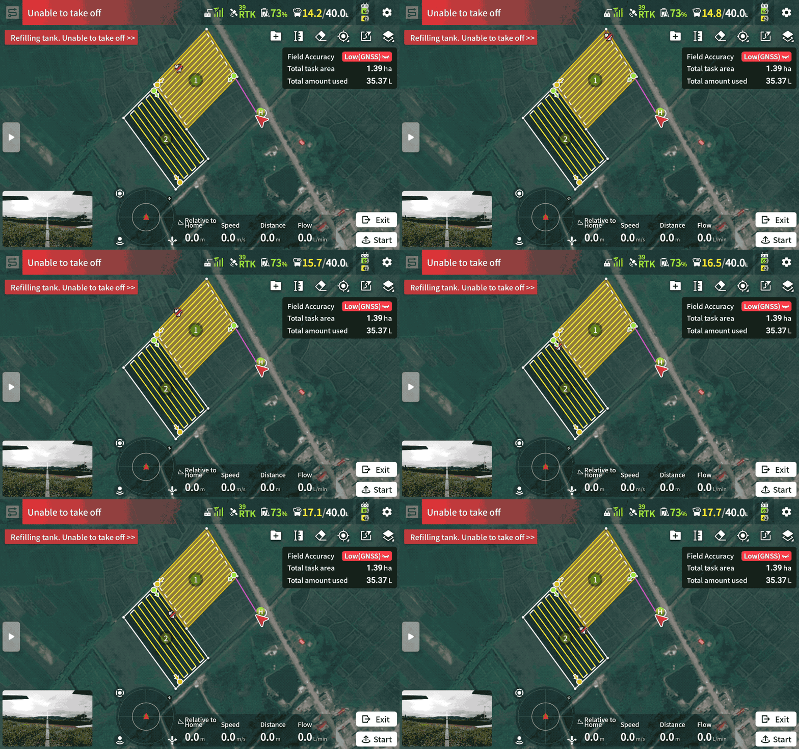
In addition, users can now select “Return Home After Completing Operation” when using Multi Plot Operations. Once enabled, the drone will automatically return to home after completing all plot operations.
Note:
- Smart Return to Home supports obstacle avoidance, but the success rate of obstacle avoidance varies with different speeds and obstacles. Please pay attention to the surrounding environment and avoid heights with power lines during return to ensure safety
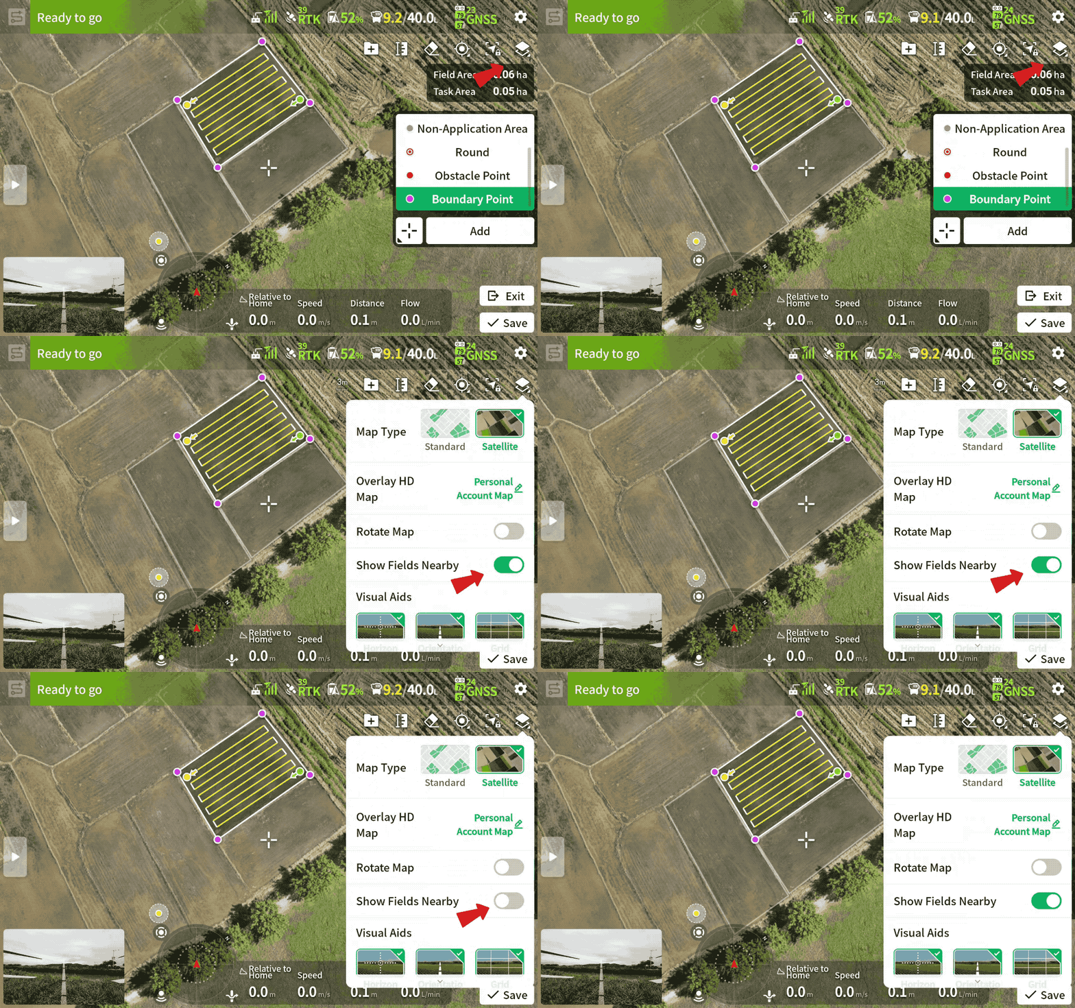
Introducing Show Fields Nearby to help avoid overlapping
The new “Show Fields Nearby” function helps users avoid overlap by displaying nearby fields on the map during field planning. It also aids in manual operations, helping to avoid accidentally entering adjacent fields.
Spray/Spread When Turning on Orchard Routes
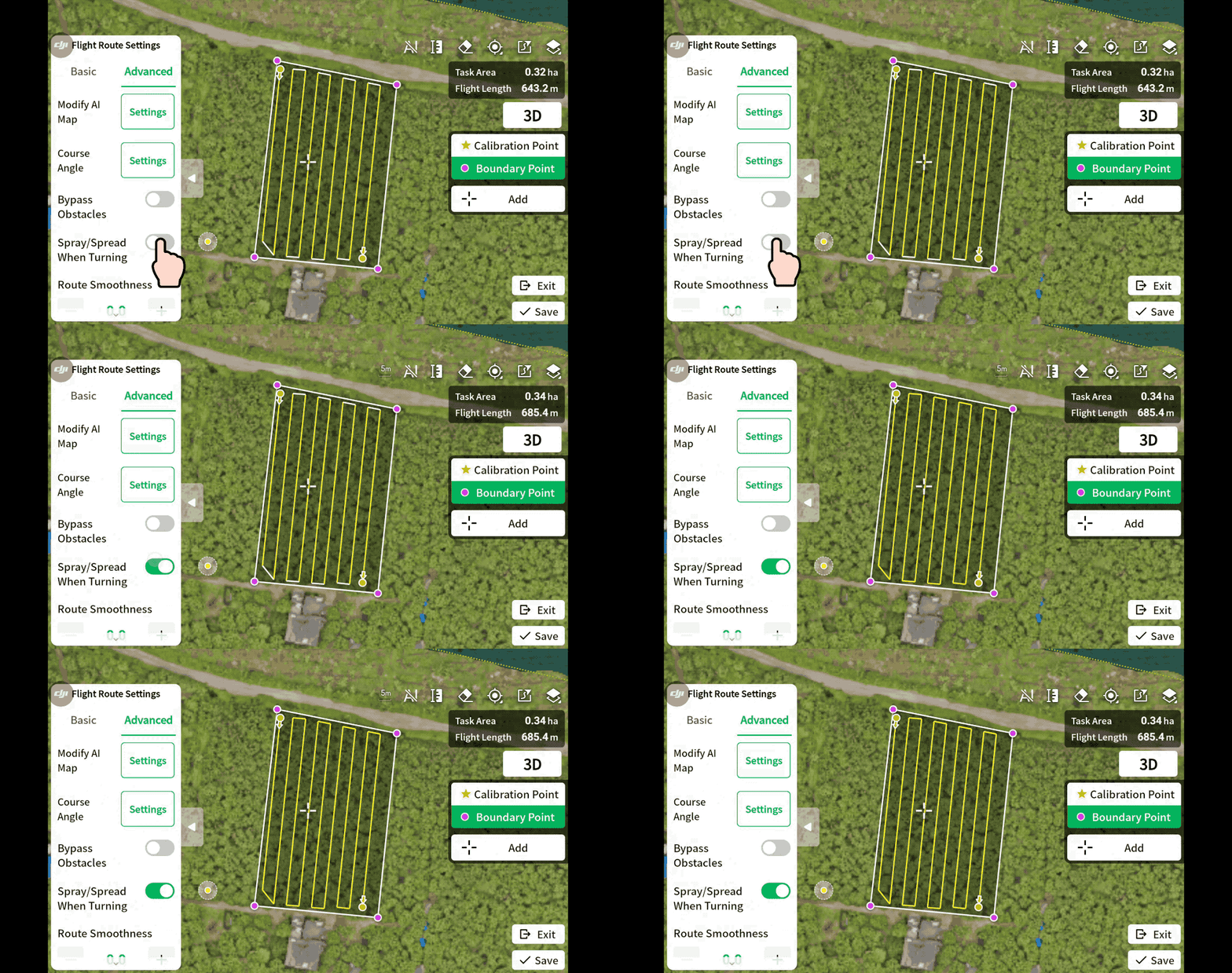
With Spray/Spread When Turning enabled, the drone will continue to spray while turning, improving edge spraying effectiveness.
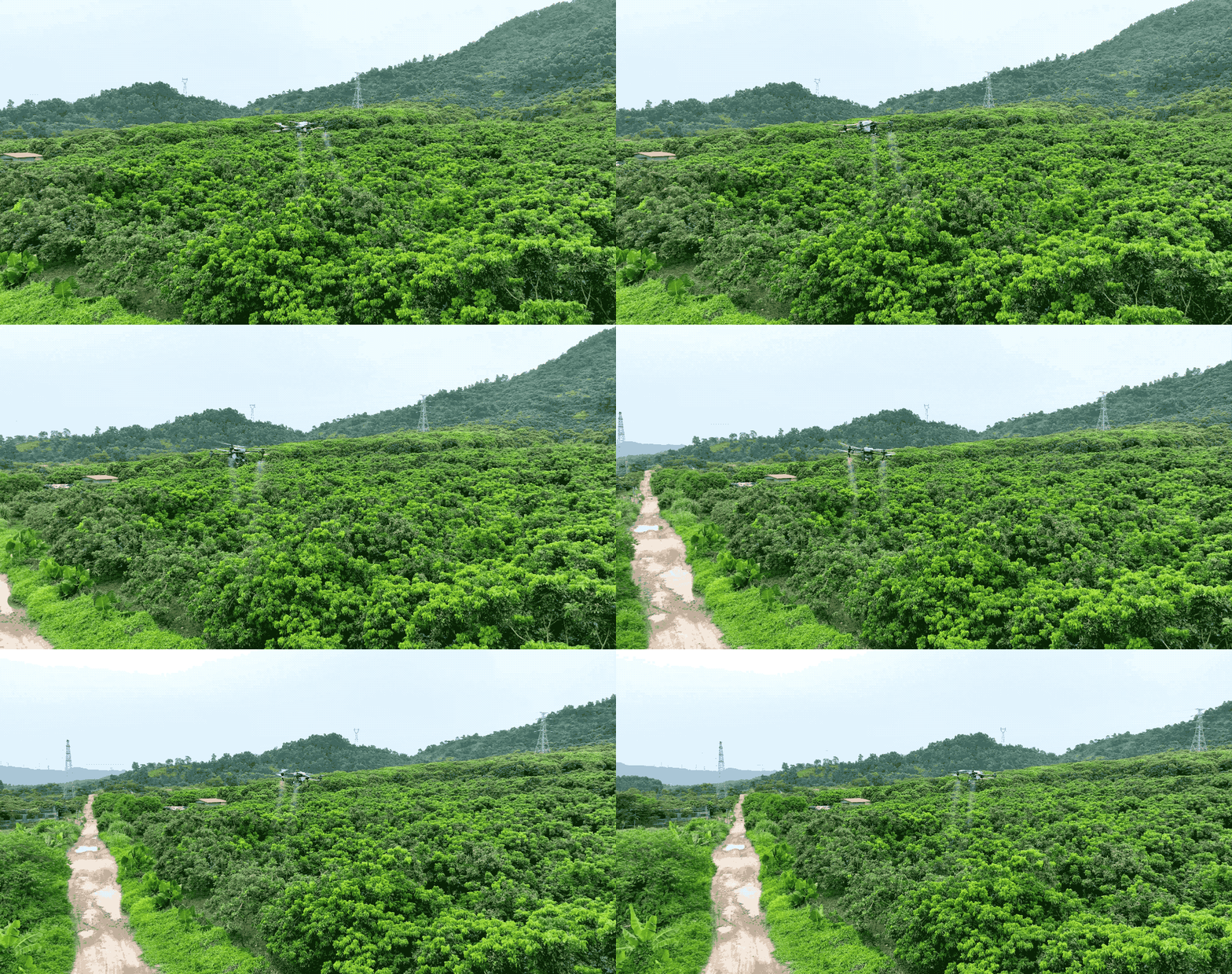
Note:
- This is only effective when the orchard route planning mode is Standard. You can enable it in the remote controller app under “Route Settings – Advanced.”
Additional Updates:
- Takeoff is prevented during refilling, enhancing safety for ground crews and operators.
- During flight, pilots can press the orange pause button on the remote controller. This will cause the drone to pause automatic flight and enter hover mode.
- After landing, propeller rotation stops two seconds faster, increasing safety and reducing downtime.
- Added support to perform spreading at the fixed-spot routes in Fruit Tree Operation mode.
- Added support to disable atomized spraying in the Fruit Tree Operation mode.
- Added support to set the terrain scenario and flight parameters in the Task Settings on the left side of the screen when applying the task.
- Optimized the display of the flight trajectory in the app. The flight routes of the latest two flights are shown in the app during the operation.
- Added warnings when the propellers are abnormal.


